By John Taylor
Photo Spelthorne Museum
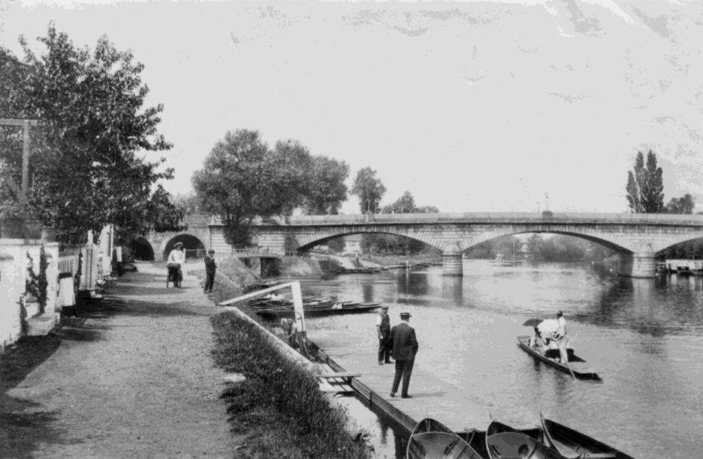
With more than 200 bridges crossing the total length of the river Thames today, the town of Staines-Upon-Thames with a population of approximately 18,500 (2022) has both a road and a separate railway bridge. In Roman times the Thames was second only to the London Road (then known as the Dev-il’s Highway) as a course through Staines. Therefore it was an important connection between the provincial capital Londinium and the west. The area’s Latin Roman name was Ad Pontes (At The Bridges), implying that there was more than one bridge traversing Church Island. Roman crossings at Staines were replaced by a wooden bridge referenced as early as 1222. That year King Henry III gave a cut tree from Windsor Forest for repairs of the bridge. Although this wooden structure lasted many years it was continually requiring reconstruction, and it was badly damaged during the English Civil War, with a ferry replacing the bridge for a while. Under an act of 1791, a stone bridge was built down-stream of the old one, but unfortunately the central arch soon cracked and a third bridge made of iron was completed in 1803. This also failed and a fourth iron replacement was opened in 1807.
The fifth and present bridge, with three arches in white granite, was designed by Sir John and George Rennie. Construction started in 1827, and it was opened in 1832, by King William IV and Queen Adelaide. This bridge crosses the Thames on the reach between Penton Hook Lock and Bell Weir Lock, and is close to and upstream of the main mouth of the river Colne, a tributary. The crossing carries the Thames Path across the river. Tolls were abolished in 1871. The City of London city limits coal tax markers are still in place on today’s bridge, which is Grade II listed. From the 1940s until the 1970s the bridge area was a hotspot for summer holiday traffic delays, due to many motorists heading from the capital towards the south-west. When the M3 and later the M25 motorways were constructed the traffic was diverted away from town.
In 1848 the railway came to Staines, new industries were established, and the town began to grow. The hamlet of Knowle Green around the station was one of the first to expand. The railway bridge was completed in 1856 to the design of John Gardner. It carries the Waterloo to Reading line, and the Water-loo to Chertsey, via Hounslow. Staines station was opened eight years earlier on the Water-loo to Windsor line. With the coming of the second line, Staines became an intersection and for many years the station was named Staines Junction.
Interestingly within the town there used to be a secondary station for Staines. Located on the north side of the high street, it was called Staines High Street Station, and was opened in August 1884 by the London and South Western Railway. More of a halt than a prop-er station, it was built of two wooden plat-forms on wooden stilts, some 20ft above street level. The line saw regular trains be-tween Waterloo and Windsor, however in its later days few stopped at High Street Station, and it closed in 1916. Unfortunately nothing remains of this disused station.

